Expedition Overview
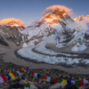
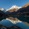
The Langtang Valley was called the Valley of Glaciers by Tilman in 1949, and despite the devastating 2015 earthquake that destroyed Langtang Village, the rebuilt community and the landscape remain among the most beautiful and accessible in Nepal. The valley is dominated by Langtang Lirung (7227m), which hangs immediately above Kyanjin Gompa — its south face so close that sérac falls are audible from the monastery courtyard.
This ten-day journey moves through lush rhododendron forest into a high-altitude valley of yak pastures, Buddhist shrines, and glacier views. The rebuilt Langtang Village community — almost entirely Tamang — offers moving documentary opportunities: a people who lost everything in 2015 and rebuilt with extraordinary resilience. Kyanjin Gompa sits at 3870m at the valley head, and the climb to Tserko Ri (4984m) gives a 360-degree view of the entire Langtang massif.
Expedition Itinerary
Day 1: Syabrubesi & Forest Entry
Drive from Kathmandu to Syabrubesi (4 hours). Walk into the forest: rhododendron, oak, and bamboo with a fast glacier river below. Langur monkeys, red pandas (rarely), and Himalayan pheasants along the route.
The Goal of the Day: Forest and wildlife photography; entering Himalayan atmosphere.
Day 2: Lama Hotel to Langtang Village
The valley opens. Waterfalls cascade from the walls above. The rebuilt Langtang Village — stone houses, prayer flags, a new gompa — gives a moving documentary photography day.
The Goal of the Day: Rebuilt community documentation; resilience and continuation after disaster.
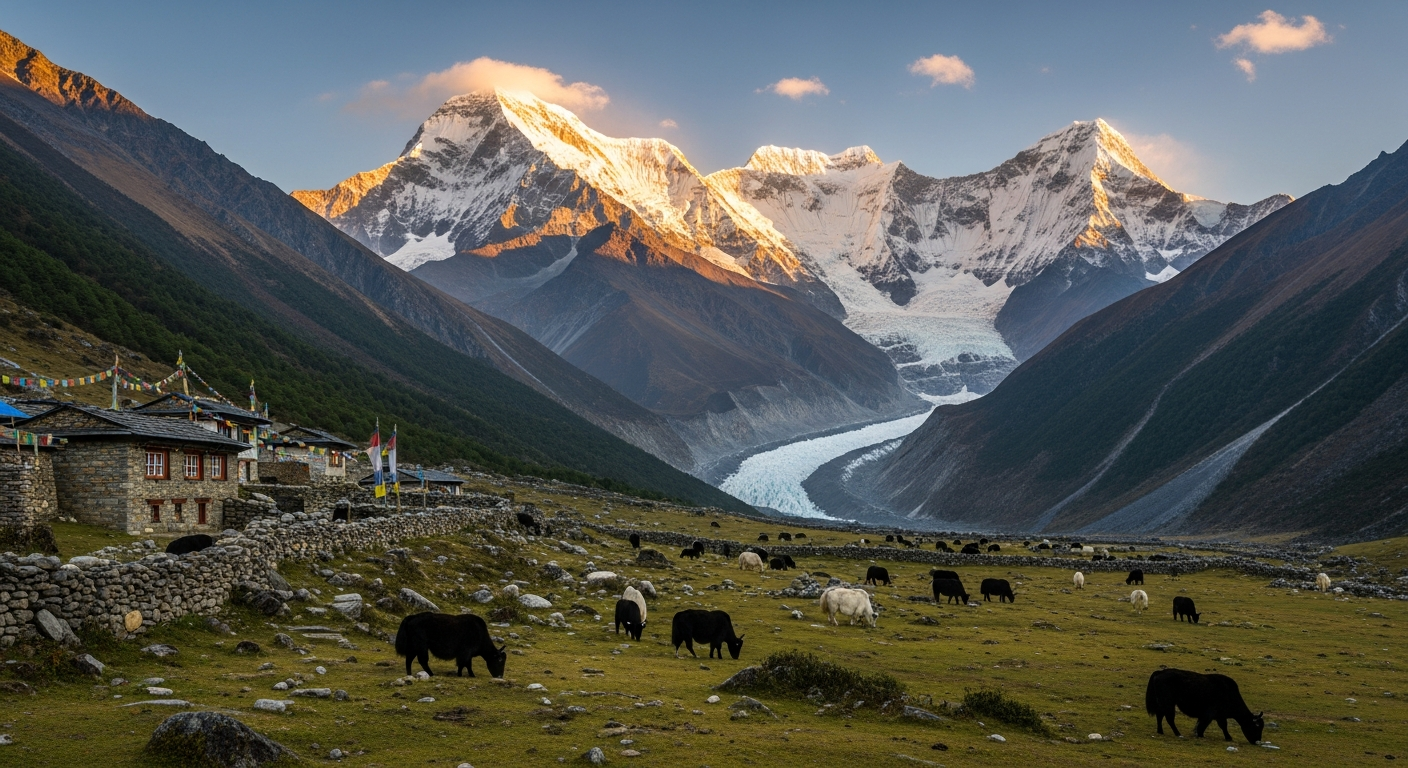
Day 3: Kyanjin Gompa & Glacier Walk
Kyanjin sits at the valley head below the immense south face of Langtang Lirung. Morning at the gompa; afternoon walk onto the glacier edge. The yak herders move between pastures in the afternoon light.
The Goal of the Day: Scale at extreme proximity — the mountain wall that fills the entire frame.
Day 4: Tserko Ri Summit (4984m)
4am departure for the summit above Kyanjin. At sunrise the entire Langtang range — Lirung, Ganesh, Dorje Lakpa — is laid out in a single panorama. Return to Kyanjin for the final portrait sessions.
The Goal of the Day: Panoramic dawn photography from altitude; the complete valley in one frame.
Day 5: Return & Tamang Heritage Trail
Descent via the Tamang Heritage Trail, a lower route through Tamang villages rarely visited by trekkers. The weaving, the local archery tradition, and the painted Buddhist houses are vivid photography material.
The Goal of the Day: Cultural documentation on a route mostly unknown to photography groups.
Book Your Expedition
Note: Final price may vary based on specific expedition details and customizations.
Expedition Leaders
Professor Nasrul Eam is a seasoned explorer and visual storyteller who has spent over two decades traversing Asia’s diverse landscapes and cultures. As Dean of the Department of Art and Photography at Light & Composition University, he leads immersive photography expeditions to regions like the Himalayas, Sundarbans, and Bali. These journeys blend cultural exploration with hands-on learning, culminating in a complete photography diploma. With a portfolio of over 50 publications—including The Quintessence of Photography and Illuminating Nature—his work captures the profound beauty of everyday life. His background in advertising, linguistics, and visual arts enriches his mentorship, guiding participants to uncover compelling narratives through their lenses. Professor Eam’s expeditions are transformative experiences, inspiring photographers to engage deeply with the world around them.
Travel Information
Syabrubesi is 4 hours from Kathmandu by road. Langtang National Park permit and TIMS required — expedition arranges. Best season: October–December and March–May.
What to Bring
• Down jacket and fleece layers
• Rain gear (forest is wet in spring)
• 70–200mm for mountain walls; 24–70mm for village and forest
• Tripod for pre-dawn Tserko Ri shoot
• Extra memory cards (10 days generates significant volume)